Dřenice I
- Quarry
- Particle morphology
- Chemical and phase composition
- Sand leachate and leachate analysis
- Physical properties
- Notes and Literature
Registry number of area: 7/1042Alternative name of quarry: Region: KarlovarskýCadastral area: Type of rock: sand
Contact
České štěrkopísky spol. s r.o. Cukrovarská 34Praha 9 - Čakovice 196 00 Tel: 354 430 337, 739 506 918 E-mail: drenice@ceske-sterkopisky.cz WWW: www.ceske-sterkopisky.czCoordinates
N: 50°04'17" E: 12°25'56"Map
Description
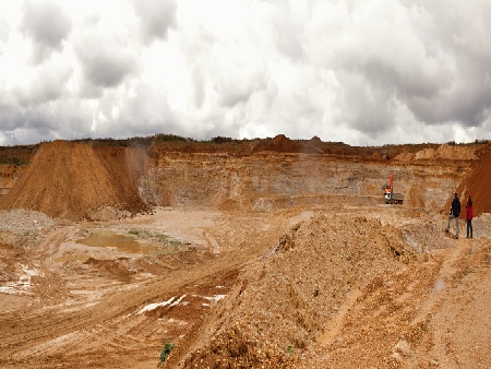
The Dřevnice sand quarry is situated between road R6 and the Jesenice water reservoir. It is accessible from the road connecting Dolní Dvory with road No. 21 via a southeast turn. Sand in Dřenice is mined on three levels from about 6 m high walls using loaders. The capping thickness reaches up to 8 m. The sand is coloured in different shades of ochre. The mined material is transported to the border of the sand quarry, where it is washed and sorted to gain-size fractions of 0-2 and 0-4 mm. In addition to sand, the quarry also produces gravel of different fractions. Mining is carried out in the southwestern and western direction.


