Dobříň
- Quarry
- Particle morphology
- Chemical and phase composition
- Sand leachate and leachate analysis
- Physical properties
- Notes and Literature
Registry number of area: 7/0824Alternative name of quarry: Region: ÚsteckýCadastral area: Type of rock: sand 
Contact
Holcim (Česko) a.s., člen koncernuTovární ul. 296Prachovice 538 04 Tel: 416 809 000/2, 602 475 313 E-mail: kamenivo-cze@holcim.com WWW: www.holcim.czCoordinates
N: 50°26'43" E: 14°18'45"Map
Photos
Description
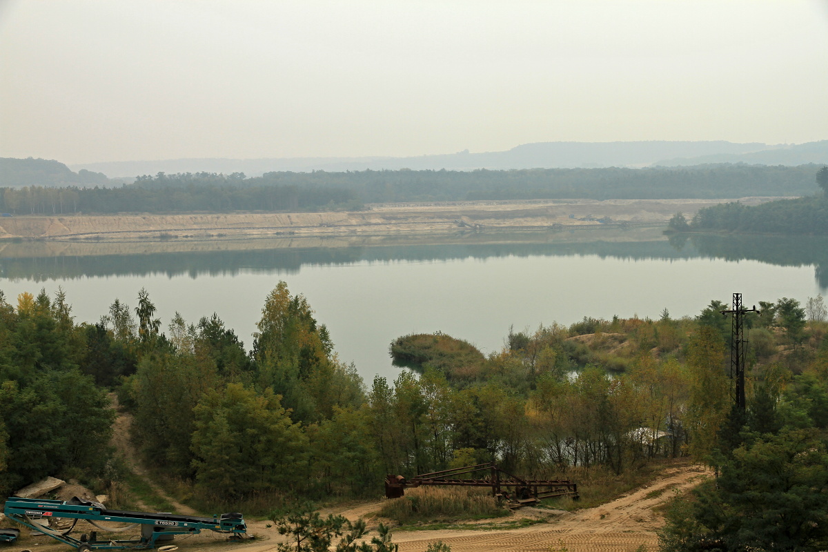
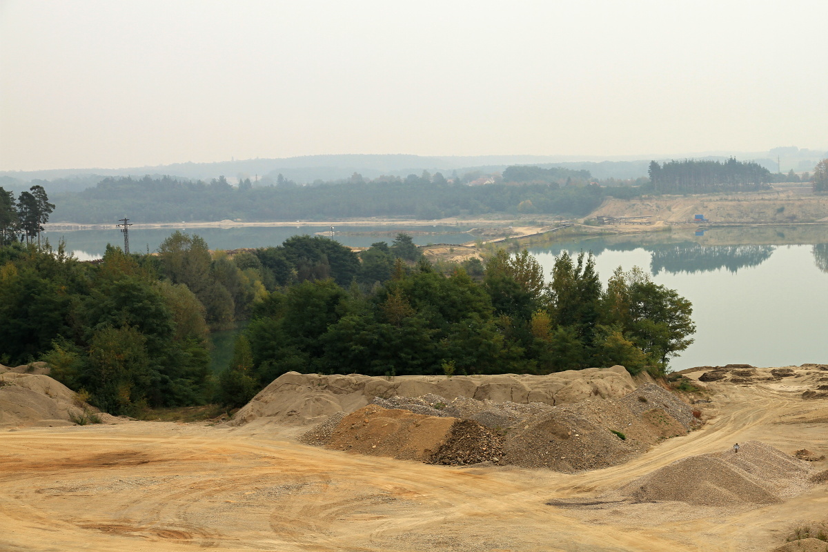
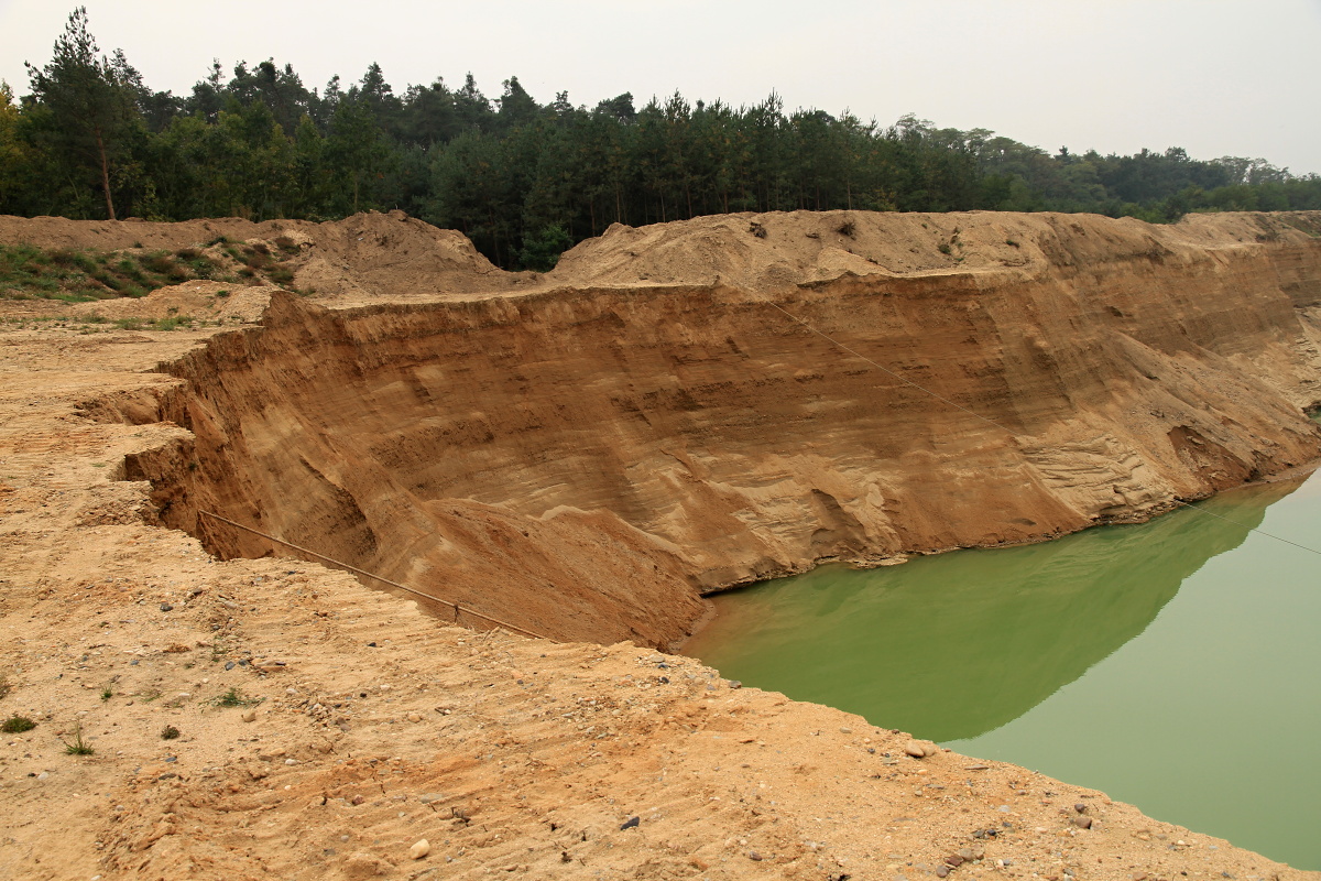
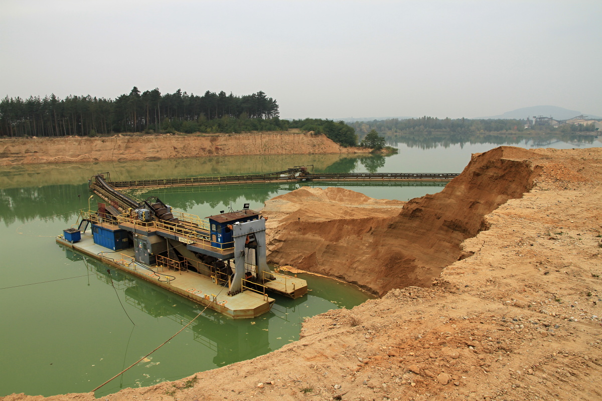
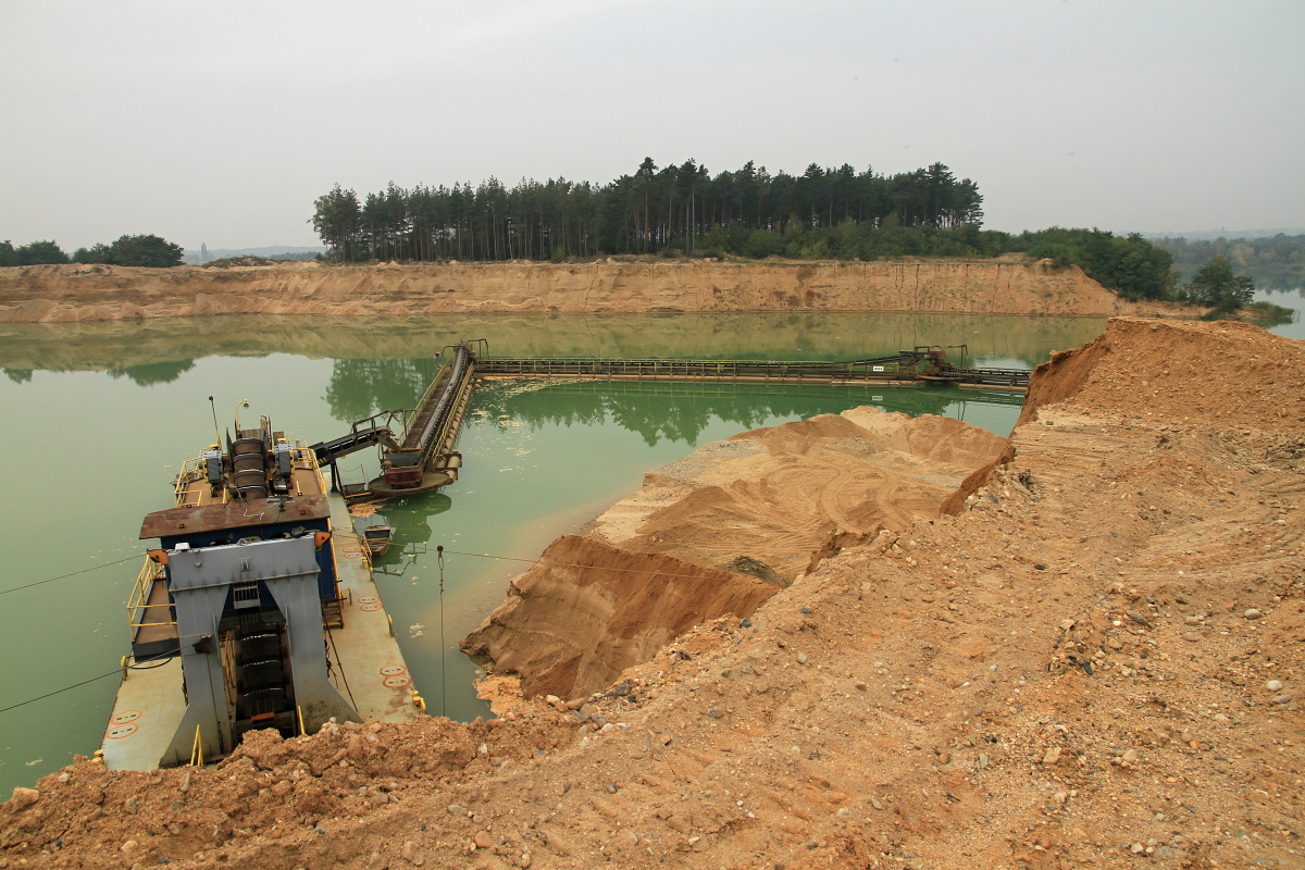
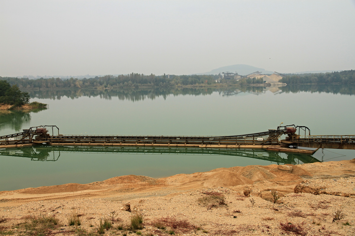
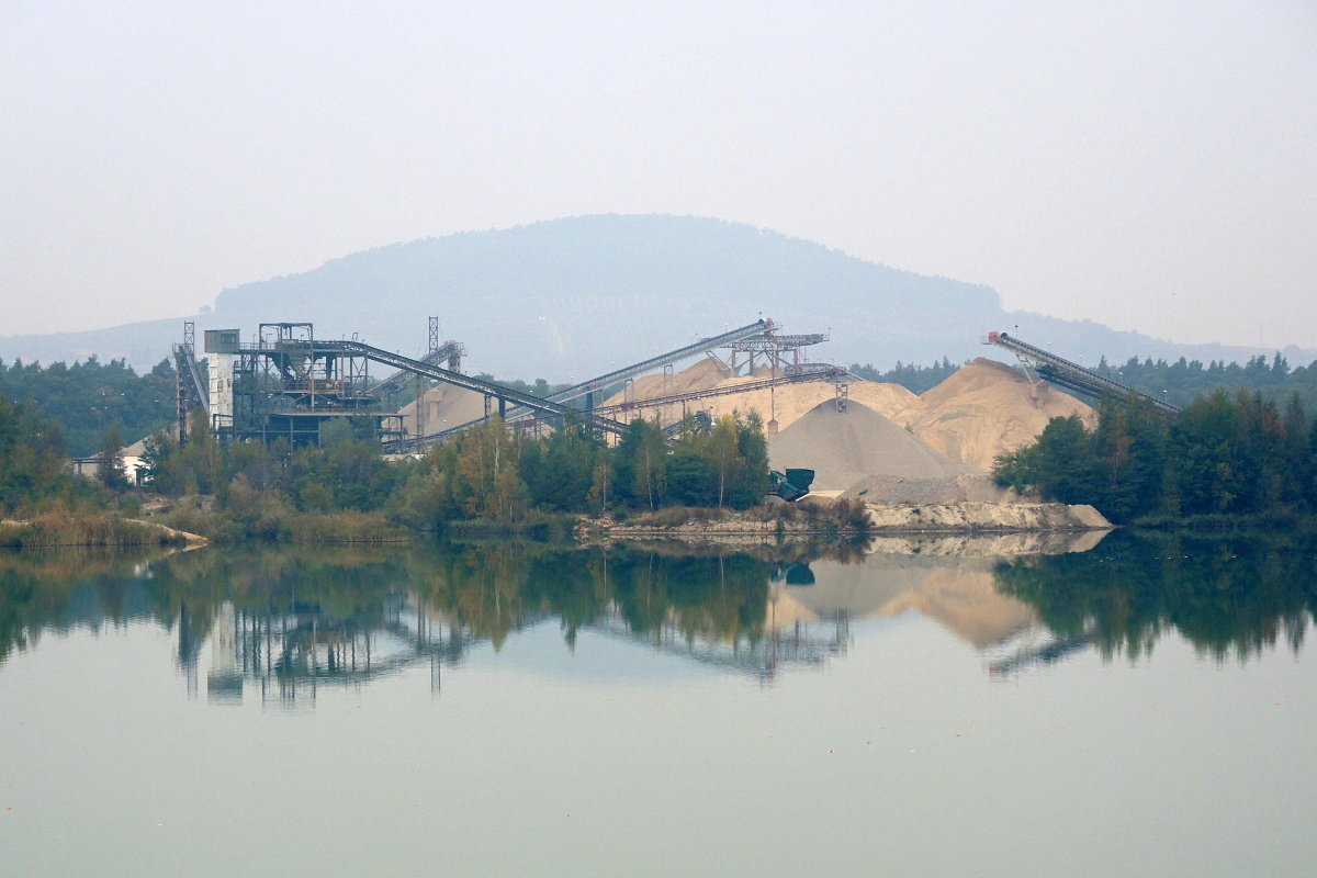
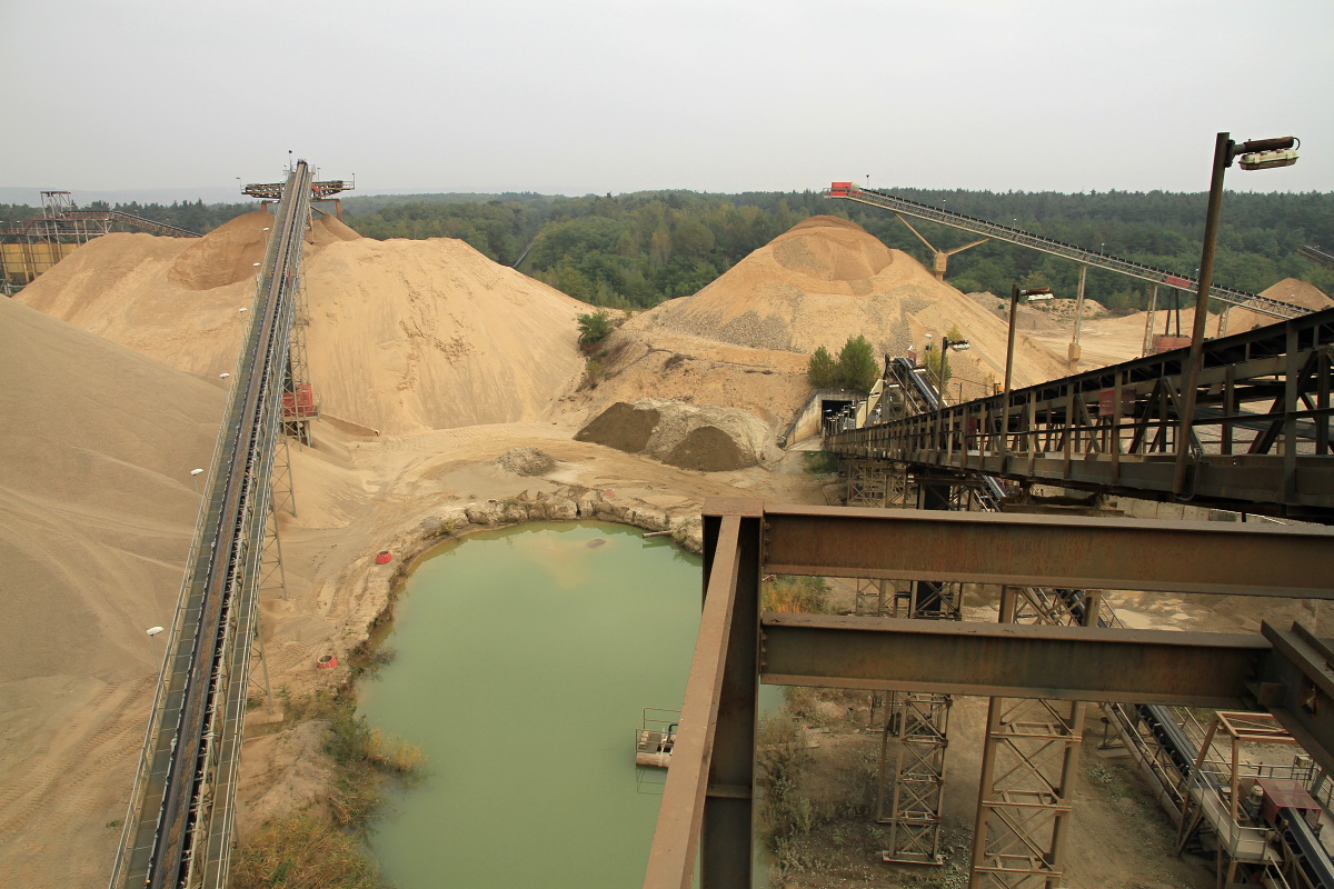
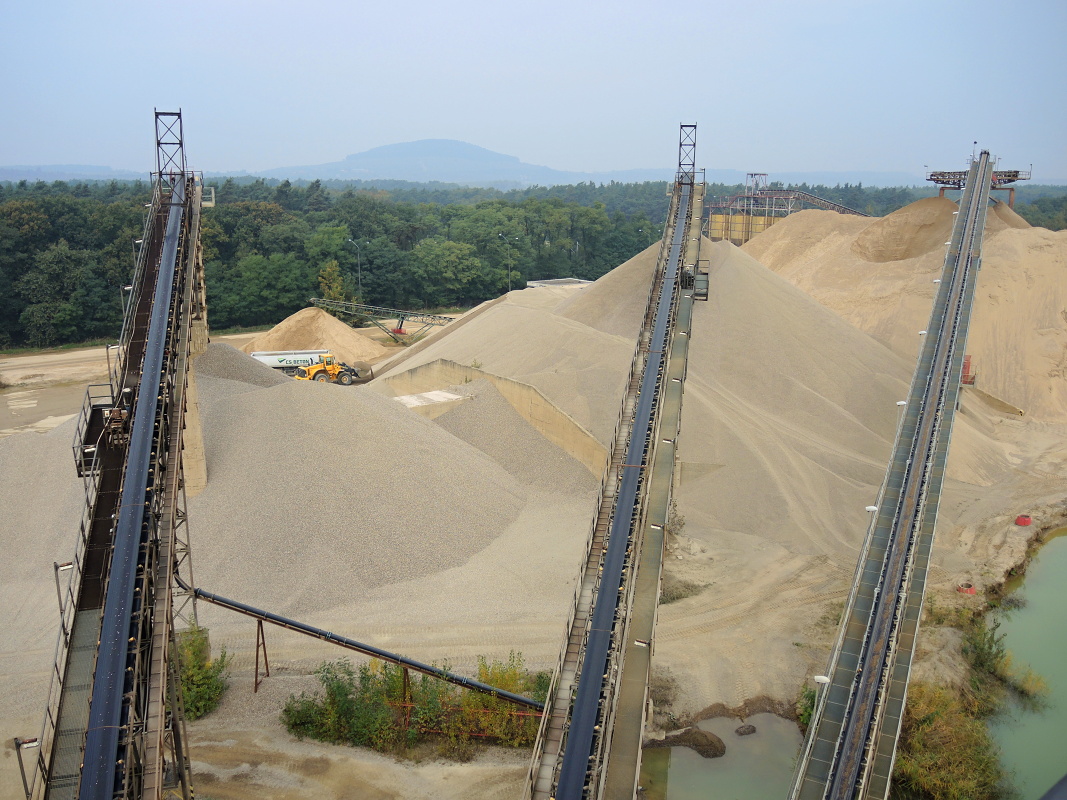
The extensive sand quarry (covering an area of about 360 ha) is located about 1.5 km northeast from the village of Dobřín, near the train track leading from Roudnice nad Labem to Kralupy nad Labem. Sand is mined by floating bucket excavators from below the water surface of two bodies of water – the Dobřínské and Račické lakes. The total wall height is up to 16 m, out of which 10 metres are above the water surface. The mined materials are transported from the quarry using belt conveyors to the treatment plant, where it is washed and sorted. The treatment plant is equipped with a grinder for the oversized parts. The quarry produces washed sand with fractions of 0-2, 0-4 and 0-8 mm.